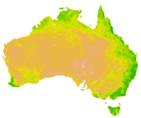
Vegetation Index

Alright kiddo, a vegetation index is a way to measure how healthy and green plants are in a specific area. You see, plants reflect different amounts of light depending on how much chlorophyll they have, which is what makes them green and helps them photosynthesize.
To measure this, we use something called a satellite. It takes pictures of the Earth and picks up different colors of light. One of these colors is called near-infrared light, and it's reflected differently by plants than it is by other things like rocks or water.
So, scientists can use the satellite images to compare the amount of near-infrared light reflected by vegetation in one area compared to another. By doing this, they can create a map that shows how healthy and green the plants are in different places.
This information is really helpful for farmers, land managers, and scientists who are studying the health of our planet. It can help them monitor crops, assess the risk of wildfires, and even track the effects of climate change.
So, in short, a vegetation index is a way to measure how healthy and green plants are in a particular area using satellite images. Cool, huh?
