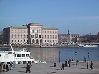
Geocoded photo

A geocoded photo is a picture that has information about where it was taken, like a secret code that tells us the exact spot! Have you ever taken a picture of something and forgot where you took it? The geocoded photo helps you find it again by giving you important information about where it was taken.
Just like how we have an address for our house, each place on the earth also has an address, called a latitude and longitude. A geocoded photo has these numbers, which show us exactly where the picture was taken somewhere on earth.
When you take a picture on your phone or camera, it can use its built-in GPS to figure out where you are standing, and automatically add this information to the photo. This is like having a secret code that is only visible to special devices like computers and smartphones.
This way, when you look back at your photos in the future, you can see where on earth the photo was taken! It’s really helpful if you want to remember a certain location or if you’re trying to find your way back to somewhere you’ve been before.
Related topics others have asked about:
