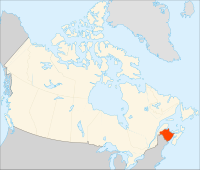
Geography of New Brunswick

Alright kiddo, today we are going to talk about the geography of New Brunswick. New Brunswick is a province located in eastern Canada and is part of the Atlantic Provinces. It is pretty big and has a lot of different types of land and water.
New Brunswick is mostly forested and has a lot of hills and mountains in the north. But, in the southern part of the province, there are a lot of towns and cities because there is more flat land.
There are three rivers that flow through New Brunswick: the Saint John River, the Miramichi River, and the Restigouche River. These rivers are very important to the people who live in New Brunswick because they use them for drinking water, fishing, and transportation.
New Brunswick also has a very long coastline, which means there is a lot of ocean around it. The Bay of Fundy is very famous because it has the highest tides in the world. That means the water goes way up and way down twice a day! This can be dangerous, but it also creates a lot of interesting things to see like tidal pools and sea caves.
Overall, New Brunswick is a really cool place with a lot of different things to explore!
