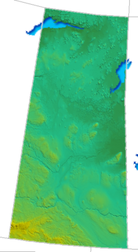
Geography of Saskatchewan

Okay kiddo, let's talk about the geography of Saskatchewan. Saskatchewan is a big province in Canada located in the middle of the country. It is sometimes called the "breadbasket of Canada" because it produces a lot of food like wheat, canola, and lentils that people eat all over the world.
Now, let's talk about what Saskatchewan looks like. It is a very flat and prairie-like with wide open spaces and big fields that go on forever. There are some rolling hills in the south and in the north, there are a lot of forests and lakes.
Saskatchewan has a lot of rivers that run through it like the Saskatchewan River, and they are important for transporting goods like grains and minerals. Saskatchewan also has many different types of weather, from very cold winters with lots of snow to hot summers with lots of sunshine.
In terms of cities, we have Regina and Saskatoon, which are the two biggest cities in Saskatchewan. They have lots of things to do like museums, parks, and shopping centers.
Lastly, it's important to know that Indigenous people have lived in Saskatchewan for thousands of years before the settlers came. They have their own languages, cultures, and traditions that are still important today. So that's a little bit about the geography of Saskatchewan, if you have any more questions, feel free to ask!
Related topics others have asked about:
