Geotagged photograph
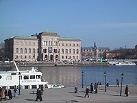
A geotagged photograph is a picture that has information about where it was taken. Just like when you draw a map and put a mark on it to show where your house is, a geotagged photograph has a marker that shows where the person taking the photo was standing when they took the picture. This marker is called a GPS coordinate and it tells us the exact location on the earth where the picture was taken.
Think of the earth as a big ball and imagine you can draw a line around it, like a belt. This line is called the 'Equator'. Now imagine drawing another line around the ball, going from the North Pole to the South Pole. This line is called the 'Prime Meridian'. When someone takes a geotagged photograph, it will have two numbers that represent where the photo was taken along these imaginary lines.
The first number tells us the distance north or south of the Equator. The second number tells us the distance east or west of the Prime Meridian. For example, if someone took a picture while standing on a beach in Miami, Florida, the GPS coordinates for that picture might be 25.7743° N, 80.1937° W. This means the picture was taken 25.7743 degrees north of the Equator and 80.1937 degrees west of the Prime Meridian.
Geotagged photographs can be useful for lots of things, like finding a good restaurant in a new city, or helping rescue workers find people who might be trapped during a disaster. It's kind of like having a digital map that lets you see exactly where something happened.
Related topics others have asked about: