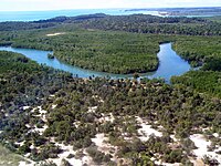
Hydrological transport model
Imagine you have a toy car and a rainy day. If you place the toy car on the ground, it will not move on its own, but if you pour water on it, it will slide or flow down the slope, carrying the car with it. Similarly, rivers and streams transport water and other things like sediment, nutrients, and pollutants from one place to another. Just like when you pour water on a toy car, the direction and speed of the water flow depend on the shape of the land, how much water is coming in, how fast it is raining, and other factors.
A hydrological transport model is a tool that scientists and engineers use to describe and predict how water, sediment, and other things move through a river system. The model uses complex math equations to simulate the behavior of water and other things in a river network, including how they interact with each other and with the environment.
The model takes input data such as rainfall patterns, temperature, land use, and topography to make predictions. By plugging in these inputs, the model can help us understand how the rivers might behave during different scenarios, such as a flood or drought. The model can also help us predict how water quality might change if certain pollutants are introduced into the river system.
In summary, a hydrological transport model is like a super-smart and complicated way to predict how water and other things move through a river system, based on things like how it is raining and what the land looks like. This tool helps people make decisions about how to effectively manage and protect the natural environment around us.
Related topics others have asked about: