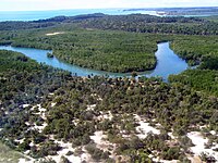
Hydrology transport model

Okay kiddo, let's imagine you have a big bowl of water. Now if you tip the bowl gently, the water will start moving from one side to the other side of the bowl, right? This is kinda like how water moves around in our world - it gets moved by different things like wind, gravity, and temperature.
So imagine you want to figure out how water moves through a big area, like a whole forest or country. That's where hydrology transport models come in - they are like special computer programs that help scientists or engineers (the people who build things) understand how water behaves over big areas.
These models work by looking at lots of data about things like rainfall, temperature, soil type, and the slope of the land. They use all this information to create a big virtual map of the area where they want to study water movement. Just like with our bowl of water, the model can predict which way the water will flow based on the shape of the land and all the other data it has.
Now the scientists or engineers can use this model to do all sorts of things, like figuring out where to build a dam or how to manage water resources in a certain area. They can also use it to make predictions about floods or droughts or other water-related events.
So basically, a hydrology transport model is a fancy computer program that helps people understand how water moves around on a big scale. Does that make sense, kiddo?
Related topics others have asked about:
