Marine spatial planning

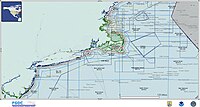
Marine spatial planning is like drawing a big map of the ocean that helps people decide where to put different things. It's kind of like a puzzle where you have to fit all the pieces together in the right way.
Imagine you're building a sand castle on the beach. You don't just plop down your sandcastle anywhere - you probably pick a spot that's not too close to the water, not too close to other people, and where the sand is nice and soft. Marine spatial planning is like doing that, but for things in the ocean like where to put wind farms, fishing areas, and shipping lanes.
People use all sorts of information to make these maps. They might look at where fish like to swim, or where turtles lay their eggs. They might look at the patterns of the waves and currents, or how deep the water is. They might even ask people who use the ocean, like fishermen, to help them decide what are the best places to put certain things.
Once they have all this information, people can make a plan for which area is good for which activity. For example, they might decide that certain areas are good for fishing, but not good for swimming. Then, they can make rules to help protect those areas and make sure that people follow the plan.
Overall, marine spatial planning is a way for people to make sure that they protect the ocean and use it in a way that works for everyone.
Related topics others have asked about:
