Orthophoto

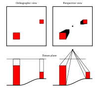
An orthophoto is an aerial photograph that has been taken from an airplane. It looks like a regular photograph except it has been corrected so that when you look at it, things appear to be in their correct places. This means that all the lines, trees, and buildings are in their correct places, as if you were looking down at them from above. Orthophoto is used in a lot of mapping and surveying applications.
Related topics others have asked about:
