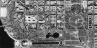
Digital orthophoto quadrangle

Hi there! Do you know what a picture is? It's something you can look at and it shows you what something looks like, just like a drawing or a painting.
Now imagine a really big picture that shows what an area of land looks like from above, like if you were a bird flying over it. That's called a map, and it has important information like where towns and cities are, where roads go, and where rivers and mountains are.
But sometimes maps can be hard to read, especially if they're not very clear. That's where a digital orthophoto quadrangle (DOQ) comes in.
A DOQ is like a really special map. It shows what an area of land looks like from above, just like a map, but it's made using special technology that makes it very clear and easy to see.
The "ortho" part of the name means that it's made so that everything in the picture looks like it's straight and flat, even though the land might be bumpy or hilly. And "quadrangle" just means that the picture shows an area of land that's in the shape of a rectangle.
So a DOQ is like a special map that shows what an area of land looks like from above, but it's made using special technology to make it really clear and easy to read. Cool, right?
Related topics others have asked about:
