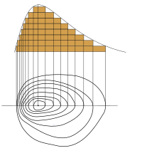
Contour line

Contour lines are lines drawn on a map or chart to show changes in elevation. They look like zig-zag lines that go up and down a mountain. They help people travelling in the mountains to know how many times the mountain goes up and down, and also tell them how high it is.
Related topics others have asked about:
