Orthophotomap

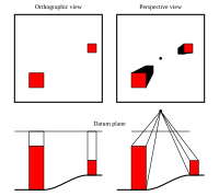
An orthophotomap is a type of aerial map that shows an aerial view of the ground. It's like a picture taken from a bird's eye view. The 'ortho' part of the name means 'correct', so the picture shows things accurately, like roads and buildings, instead of just blobs of color. All the shapes in the picture have a true size and location, which makes it easier to use than a regular map. Orthophotomaps are useful for city planners, scientists, developers, or anyone who wants to understand what the ground looks like from an aerial point of view.
Related topics others have asked about:
