Public transport route planner

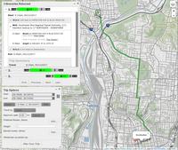
A public transport route planner is a special tool that helps you figure out how to get from one place to another using buses, trains, or other forms of public transportation. It works kind of like a map, but instead of showing you all the streets and buildings, it shows you all the different bus or train routes you can take to get where you want to go.
Here's how it works:
Imagine you wanted to go to the park to play with your friends. First, you would type the address of the park into the route planner. Then, you would tell it where you're starting from (like your house or school).
The route planner would then show you all the different buses or trains you could take to get to the park. It would show you what time they leave, what stops they make along the way, and how long it would take to get there.
You could also use the route planner to figure out how to get back home from the park. You would just type in your home address and the route planner would calculate the best way to get there using public transportation.
Using a route planner can be really helpful if you're visiting a new city or if you're not familiar with the public transportation system in your own city. It can help you save time, money, and avoid getting lost.
Related topics others have asked about:
