Raised-relief map
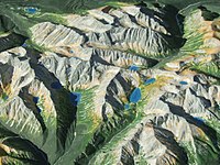
A raised-relief map is a map that shows land and water features in 3-D, meaning it looks like you are seeing them from above but also at an angle. Think of when you put together a 3-D puzzle, with separate pieces that have to fit together. That's what a raised-relief map looks like. Instead of being flat like most maps, these maps have raised pieces that show different features like hills, mountains, lakes, and rivers! They are meant to give the viewer a better sense of what a place looks like in real life.
Related topics others have asked about: