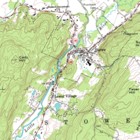
Terrain cartography

Terrain cartography is the process of making maps that represent the shape of the ground. It helps us to know what the land looks like, and to find paths that are safe and easy to walk on. To make terrain maps, surveyors measure and record the height, shape and position of the land in all directions. Then, they use special types of software to put all this information together in a map. The map will show us the contours (the lines showing bumps and hollows in the land), rivers and forests, cities and towns, roads and more. By looking at one of these maps, we get a sense of how the land looks at that particular place without having to leave our house.
Related topics others have asked about:
