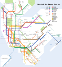
Transit map

A transit map is like a picture book that shows you all the places you can go on a train, bus or subway. Just like how a map helps you find your way to a new location, a transit map helps you find your way from one place to another using public transportation.
Imagine you want to go to a new toy store in a different part of the city. You can use a transit map to find which train, bus or subway to take to get there. The map will show you all the different public transportation options you can take to reach your destination.
The transit map is designed to be easy to understand, even for young kids! It uses colorful lines to represent different train, bus or subway routes. Each line has a unique color and name, like the red line or the blue line.
The map also shows important stops along the way, like major train stations or important landmarks. You can use these stops to help navigate your way to your destination.
So the next time you want to explore a new part of the city, don't forget to use a transit map to help you get there! It's like your very own treasure map with all the secrets to getting around the city using public transportation.
Related topics others have asked about:
