Geographic Information Systems

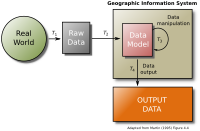
Geographic Information Systems (GIS) are computer systems that help people look at and understand things on the earth. They allow people to see what is on the earth and how things are connected in a way that people cannot do with maps. GIS combines information from the real world, like images, roads, and boundaries, with information from computers, like numbers and symbols. With GIS, people can look at things like political boundaries, population changes, land use, and many other things all at the same time. GIS is like a big puzzle with lots of pieces, and it can help people ask questions and answer them about the Earth.
Related topics others have asked about:
