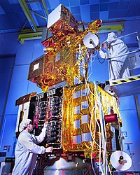
Landsat

Landsat is like a big camera that takes pictures of the Earth from space. It helps us see and understand things like where there is a lot of vegetation, how the water is moving, where there is a lot of pollution, and how the land is changing over time. It's like Google Maps, but it shows you even more detailed and precise images.
Landsat takes many different types of pictures, including black-and-white, false color images, and thermal images. Black-and-white images show us what things look like on the ground, while false-color images help us see things like water and vegetation more clearly. Thermal images help us see how hot or cold things are, which can be useful for things like monitoring wildfires.
Scientists and researchers use Landsat to study things like climate change, natural disasters, and land use. They can look at the pictures taken by Landsat over time and see how things are changing in different parts of the world.
Overall, Landsat is like a really useful tool for understanding what's happening on our planet from space.
Related topics others have asked about:
