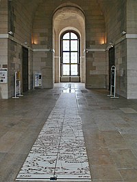
Paris meridian

The Paris Meridian is like a big imaginary line that goes around the Earth from the North Pole to the South Pole. It helps people figure out where places are on a map or a globe. Sort of like how you draw lines on a treasure map to figure out where X marks the spot!
But why is it called the Paris Meridian? Well, a long time ago, some really smart people in France decided to use this line as a standard for measuring how far east or west a place was. They chose a specific spot in Paris to be the "prime meridian" (which means "first meridian"), and made all their calculations based on that point. It's kind of like how your mom might use a ruler to measure how tall you are - she chooses a starting point on the ruler and then measures up from there.
Nowadays, most maps and globes use a slightly different "prime meridian" that goes through Greenwich, England. But the Paris Meridian is still important because it was one of the first meridians ever used, and helped people figure out how to navigate and explore the world!
Related topics others have asked about:
