Landsat program

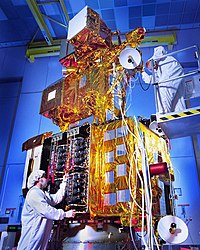
The Landsat Program is a U.S. government program that sends satellites into space to take pictures of Earth. These satellites capture images of different parts of Earth every day. Scientists use these images to study how Earth has changed over time. They use them to help understand how humans are impacting the environment, to monitor changes in plants and animals, to predict natural disasters, and to help decide how to use land.
Related topics others have asked about:
