Satellite meteorology

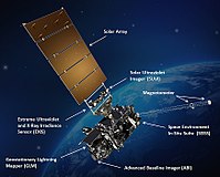
Imagine if you could see the whole world from way up high in the sky! That's what satellite meteorology does! A satellite is like a robot friend that takes pictures of the Earth from space.
So when we say "meteorology," we're talking about weather. It's like looking at the map on your weather app, only we can see way more than just your town or city. Satellites fly around the Earth and take pictures of the clouds, the ocean, and even the land. They can tell us where it's hot and where it's cold. They can even watch storms happening as they move across the planet.
Scientists use the pictures from satellite meteorology to help predict the weather. They look at how the clouds are moving and where the storms are going, and then they guess what the weather will be like in different parts of the world. The pictures from satellite meteorology can help people plan their day or even save their lives during a big storm.
So, in short, satellite meteorology is like having a robot helper in space who takes pictures of the Earth and helps us predict the weather.
Related topics others have asked about:
