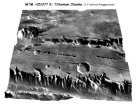
Digital Elevation Model

A digital elevation model (DEM) is a 3-D map of an area's surface. It shows a picture of the land's height and shape, like a mountain range or a hill. The DEM helps us understand the land and water around us. DEMs are made up of tiny squares called grid cells. Each grid cell is filled with a number or a pixel that tells us the height of that part of the landscape. DEMs are like virtual models of the land that help us understand how the land looks and works.
Related topics others have asked about:
