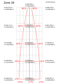
Projected coordinate system

Okay kiddo, imagine you are drawing a map of your classroom on a piece of paper. Now let's say you want to show the exact location of each desk and chair in the classroom on the map, but you also want to show the shape and size of the room too.
When you draw the map, you have to decide on a way to show where each desk and chair is located in the classroom. This is called a coordinate system.
A projected coordinate system is a way to take the shape of the classroom and flatten it into a two-dimensional map. It's like taking a picture of your classroom and then tracing it onto a piece of paper.
To make sure that the map is accurate and matches up with the real world, a projected coordinate system uses mathematical formulas to flatten the three-dimensional shape of the classroom into a two-dimensional map.
This means that when you look at the map, you can see where each desk and chair is located in the classroom, and also where the walls and doors are, even though they're not shown on the map.
Different areas of the world use different projected coordinate systems, depending on the shape of the land and how they want to show it on a map. It's like how different classrooms might have different shapes and sizes, so they need different maps to show where everything is located.
So, a projected coordinate system is like a special way of flattening the world onto a 2D map so we can see where everything is located.
Related topics others have asked about:
