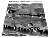
Digital surface model

A digital surface model is like a computer drawing of what the Earth's surface looks like. Think of it like a big map made on the computer that shows how high or low the ground is in different places. This map can be made using special equipment called satellites or airplanes that take pictures of the ground from above.
When making a digital surface model, the pictures are put together in a way that creates a 3D picture of the Earth's surface. This means that you can see mountains, valleys, and even buildings!
People use digital surface models for all kinds of things, like planning where to build things or studying how the land changes over time. It's like having a really detailed and accurate picture of what the ground looks like from a bird's-eye-view.
Related topics others have asked about:
